

BUCKNACKT'S SORDID TAWDRY BLOG We should not be a journey to the grave with the intention of arriving safely in an attractive & well preserved body, but rather to skid in sideways, chocolate, bier or wein in hand, body thoroughly used up, totally worn out and screaming "WHOO-HOO, WHAT A RIDE!!!!!!"
Showing posts with label wine. Show all posts
Showing posts with label wine. Show all posts
22 August 2014

13 February 2014
THE LATEST WEATHER UPDATE FOR HERNDON & NORTHERN VIRGINIA FROM USWX 13FEB14
IT is freezing mist / rain here now, but not an ice fog thank God! Here is the latest on our forecast from USWX, we are still under a Winter storm warning, more snow on the way!!!!!
Winter storm watches, warnings, and advisories are issued by local National Weather Service Forecast offices.
Winter weather advisory -- When a significant winter storm or hazardous winter weather is occurring, imminent, and is an inconvenience.
Winter storm watch -- A significant winter weather (i.e., heavy snow, heavy sleet, significant freezing rain, or a combination of events) is expected, but not imminent, for the watch area; provides 12 to 36 hours notice of the possibility of severe winter weather.
Winter storm warning -- A significant winter storm or hazardous winter weather is occurring, imminent, or likely, and is a threat to life and property.
Blizzard warning -- Winds that are at least 35 mph or greater, blowing snow that will frequently reduce visibility to 1/4 mile or less for at least three hours, and dangerous wind chills are expected in the warning area.
Wind chill index -- The calculation of temperature that takes into consideration the effects of wind and temperature on the human body. This is not the actual air temperature, but what it feels like to the average person. This wind chill chart shows the difference between actual air temperature and perceived temperature, and the amount of time until frostbite occurs.


http://uswx.com/uswx/local.php?q=20170&x=15&y=8
http://uswx.com/uswx/state.php?q=VA
Winter storm watches, warnings, and advisories are issued by local National Weather Service Forecast offices.
Winter weather advisory -- When a significant winter storm or hazardous winter weather is occurring, imminent, and is an inconvenience.
Winter storm watch -- A significant winter weather (i.e., heavy snow, heavy sleet, significant freezing rain, or a combination of events) is expected, but not imminent, for the watch area; provides 12 to 36 hours notice of the possibility of severe winter weather.
Winter storm warning -- A significant winter storm or hazardous winter weather is occurring, imminent, or likely, and is a threat to life and property.
Blizzard warning -- Winds that are at least 35 mph or greater, blowing snow that will frequently reduce visibility to 1/4 mile or less for at least three hours, and dangerous wind chills are expected in the warning area.
Wind chill index -- The calculation of temperature that takes into consideration the effects of wind and temperature on the human body. This is not the actual air temperature, but what it feels like to the average person. This wind chill chart shows the difference between actual air temperature and perceived temperature, and the amount of time until frostbite occurs.
Thursday, February 13, 2014, 2:21 PM EST
|
Herndon, VA
County: Fairfax NWS Zone: VAZ053 (Fairfax) 2:21 PM EST (19:21 GMT) |
77.3873 W
38.9812 N Thu, Feb 13, 2014 |
| Severe Weather Statements | |||
| Type | Issue Time | Expire Time | Expires in |
|
|
Thu, Feb 13, 1:00pm EST | Thu, Feb 13, 6:00pm EST | 3 hr, 38 min |
|
|
Thu, Feb 13, 12:59pm EST | Thu, Feb 13, 6:00pm EST | 3 hr, 38 min |
|
|
Thu, Feb 13, 2:15pm EST | Thu, Feb 13, 10:15pm EST | 7 hr, 53 min |
| Current Conditions | |||||||||||||||||||||||||||||||||||||
Observation for Dulles Airport, Chantilly, VA as of 1:52PM (29 min ago)
|
|||||||||||||||||||||||||||||||||||||

| National Weather Service Forecast | |
|
|
|
| This afternoon | Sleet, freezing rain, snow and rain. Additional snow and sleet accumulation around an inch. Highs in the lower 30s. North winds around 15 mph with gusts up to 30 mph. Chance of precipitation near 100 percent. |
| Tonight | Snow. Total snow accumulation of 10 to 14 inches. Lows in the mid 20s. Northwest winds 15 to 20 mph with gusts up to 30 mph. Chance of snow near 100 percent. |
| Friday | Mostly sunny. Highs in the upper 30s. Southwest winds 5 to 10 mph. |
| Friday night | Cloudy. A chance of snow and rain showers in the evening, then snow showers after midnight. Lows in the upper 20s. West winds around 5 mph, becoming north after midnight. Chance of precipitation 90 percent. |
| Saturday | Mostly sunny. A chance of snow showers in the morning. Highs in the lower 30s. Northwest winds 10 to 15 mph with gusts up to 25 mph. Chance of snow 30 percent. |
| Saturday night | Mostly cloudy. Lows around 20. |
| Sunday | Partly sunny. Highs in the lower 30s. |
| Sunday night | Mostly clear. Lows 15 to 20. |
| Washingtons birthday | Partly sunny. Highs in the upper 30s. |
| Monday night | Mostly cloudy with a chance of rain and snow showers. Lows in the lower 30s. Chance of precipitation 30 percent. |
| Tuesday | Partly sunny. Highs in the upper 40s. |
| Tuesday night | Partly cloudy. Lows in the upper 20s. |
| Wednesday | Mostly sunny. Highs in the lower 50s. |
| Area Conditions | Eng | |||||||
| Dist | Stn | City | Temp | Dew | Cond | Wind | Vis | Age |
| 5 mi | KIAD | Chantilly, VA | Light Drizzle, Mist | 29 | ||||
| 12 mi | KJYO | Leesburg, VA | Unknown Precipitation | 26 | ||||
| 21 mi | KDCA | Arlington, VA | Light Drizzle, Mist | 29 | ||||
| 21 mi | KDAA | Fort Belvoir, VA | Light Rain, Mist | 13 | ||||
| 30 mi | KFDK | Frederick, MD | Light Rain | 36 | ||||
| 31 mi | KADW | Andrews Air Force Base, MD | Light Rain, Mist | 23 | ||||
| 34 mi | KFME | Laurel, MD | Cloudy | 21 | ||||
| 34 mi | KNYG | MCB Quantico, VA | Light Rain, Mist | 17 | ||||
| 40 mi | KCJR | Elkwood, VA | Mist | 26 | ||||
| 40 mi | KBWI | Glen Burnie, MD | Light Drizzle, Mist | 27 | ||||
| 40 mi | KRMN | Fredericksburg, VA | Mist | 26 | ||||
| 43 mi | KOKV | Winchester, VA | Light Snow | 6 | ||||
| 43 mi | KMRB | Martinsburg, WV | Light Snow | 28 | ||||
| 46 mi | KDMH | Baltimore, MD | - | 27 | ||||
| 49 mi | KEZF | Fredericksburg, VA | Mist | 26 | ||||
Thursday, February 13, 2014, 2:26 PM EST
|
Virginia
2:26 PM EST (19:26 GMT) |
79.4671 W
38.0044 N |

| Severe | Temp | Dew Point | Feels Like | Humidity | Pressure | Wind Speed | Wind Dir |
| Severe Weather Statements | |||
| Type | Areas Affected | ||
|
|
Lee, Russell, Scott, Washington, Wise | ||
|
|
Buchanan, Dickenson | ||
|
|
Caroline, Fluvanna, Goochland, Hanover, Louisa | ||
|
|
Amelia, Charles City, Chesterfield, Cumberland, Dinwiddie, Henrico, New Kent, Nottoway, Powhatan, Prince Edward, Prince George | ||
|
|
Greensville, Sussex | ||
|
|
Essex, King William, King and Queen, Lancaster, Northumberland, Richmond, Westmoreland | ||
|
|
Brunswick, Lunenburg, Mecklenburg | ||
|
|
Tazewell | ||
|
|
Alleghany, Amherst, Appomattox, Bath, Bedford, Bland, Botetourt, Buckingham, Campbell, Carroll, Craig, Floyd, Franklin, Giles, Grayson, Montgomery, Patrick, Pulaski, Roanoke, Rockbridge, Smyth, Wythe | ||
|
|
Charlotte, Halifax, Henry, Pittsylvania | ||
|
|
Arlington/Falls Church/Alexandri, King George | ||
|
|
Albemarle, Augusta, Culpeper, Eastern Highland, Greene, Madison, Nelson, Orange, Page, Rappahannock, Rockingham, Shenandoah, Spotsylvania, Western Highland | ||
|
|
Clarke, Fairfax, Frederick, Loudoun, Northern Fauquier, Prince William/Manassas/Manassas, Southern Fauquier, Stafford, Warren | ||
|
|
Albemarle, Arlington/Falls Church/Alexandri, Augusta, Clarke, Culpeper, Eastern Highland, Fairfax, Frederick, Greene, King George, Loudoun, Madison, Nelson, Northern Fauquier, Orange, Page, Prince William/Manassas/Manassas, Rappahannock, Rockingham, Shenandoah, Southern Fauquier, Spotsylvania, Stafford, Warren, Western Highland | ||
|
|
Albemarle, Arlington/Falls Church/Alexandri, Augusta, Clarke, Culpeper, Eastern Highland, Fairfax, Frederick, Greene, King George, Loudoun, Madison, Nelson, Northern Fauquier, Orange, Page, Prince William/Manassas/Manassas, Rappahannock, Rockingham, Shenandoah, Southern Fauquier, Spotsylvania, Stafford, Warren, Western Highland | ||
|
|
Bedford, Botetourt, Floyd, Franklin, Henry, Patrick, Pittsylvania, Roanoke | ||
12 February 2014
WINTER STORM WARNING FOR HERNDON & NORTHERN VIRGINIA 12FEB14
THE latest weather forecast for Herndon, VA and Northern Virginia from USWX, we have been upgraded from a Winter storm watch to a Winter storm warning......
Winter storm watches, warnings, and advisories are issued by local National Weather Service Forecast offices.
Winter weather advisory -- When a significant winter storm or hazardous winter weather is occurring, imminent, and is an inconvenience.
Winter storm watch -- A significant winter weather (i.e., heavy snow, heavy sleet, significant freezing rain, or a combination of events) is expected, but not imminent, for the watch area; provides 12 to 36 hours notice of the possibility of severe winter weather.
Winter storm warning -- A significant winter storm or hazardous winter weather is occurring, imminent, or likely, and is a threat to life and property.
Blizzard warning -- Winds that are at least 35 mph or greater, blowing snow that will frequently reduce visibility to 1/4 mile or less for at least three hours, and dangerous wind chills are expected in the warning area.
Wind chill index -- The calculation of temperature that takes into consideration the effects of wind and temperature on the human body. This is not the actual air temperature, but what it feels like to the average person. This wind chill chart shows the difference between actual air temperature and perceived temperature, and the amount of time until frostbite occurs.
http://uswx.com/uswx/local.php?q=20170&x=9&y=6
http://uswx.com/uswx/state.php?q=VA
Winter storm watches, warnings, and advisories are issued by local National Weather Service Forecast offices.
Winter weather advisory -- When a significant winter storm or hazardous winter weather is occurring, imminent, and is an inconvenience.
Winter storm watch -- A significant winter weather (i.e., heavy snow, heavy sleet, significant freezing rain, or a combination of events) is expected, but not imminent, for the watch area; provides 12 to 36 hours notice of the possibility of severe winter weather.
Winter storm warning -- A significant winter storm or hazardous winter weather is occurring, imminent, or likely, and is a threat to life and property.
Blizzard warning -- Winds that are at least 35 mph or greater, blowing snow that will frequently reduce visibility to 1/4 mile or less for at least three hours, and dangerous wind chills are expected in the warning area.
Wind chill index -- The calculation of temperature that takes into consideration the effects of wind and temperature on the human body. This is not the actual air temperature, but what it feels like to the average person. This wind chill chart shows the difference between actual air temperature and perceived temperature, and the amount of time until frostbite occurs.
Wednesday, February 12, 2014, 6:19 PM EST
|
Herndon, VA
County: Fairfax NWS Zone: VAZ053 (Fairfax) 6:19 PM EST (23:19 GMT) |
77.3873 W
38.9812 N Wed, Feb 12, 2014 |
| Type | Issue Time | Expire Time | Expires in |
|
|
Wed, Feb 12, 3:08pm EST | Wed, Feb 12, 11:15pm EST | 4 hr, 55 min |
| Current Conditions | |||||||||||||||||||||||||||||||||||||
Observation for Dulles Airport, Chantilly, VA as of 5:52PM (27 min ago)
|
|||||||||||||||||||||||||||||||||||||

| National Weather Service Forecast | |
|
|
|
| Rest of this afternoon | Cloudy. Highs in the upper 20s. East winds around 10 mph. |
| Tonight | Snow. Snow may be heavy at times after midnight. Snow accumulation of 4 to 6 inches. Lows in the mid 20s. Northeast winds 10 to 15 mph. Chance of snow near 100 percent. |
| Thursday | Snow and sleet in the morning, then sleet, snow and rain in the afternoon. Additional snow and sleet accumulation of 2 to 4 inches. Highs in the mid 30s. North winds 15 to 20 mph. Chance of precipitation near 100 percent. |
| Thursday night | Mostly cloudy. Snow likely or rain in the evening, then a chance of snow after midnight. Lows in the mid 20s. Northwest winds 15 to 20 mph. Chance of precipitation 80 percent. |
| Friday | Mostly sunny. Highs in the lower 40s. Southwest winds 5 to 10 mph. |
| Friday night | Mostly cloudy with a 30 percent chance of snow showers. Lows in the mid 20s. |
| Saturday | Mostly sunny. Highs in the mid 30s. |
| Saturday night | Mostly cloudy. Lows around 15. |
| Sunday | Partly sunny. Highs in the lower 30s. |
| Sunday night | Clear. Cold with lows around 10 above. |
| Washingtons birthday | Mostly sunny. Highs in the upper 30s. |
| Monday night | Cloudy with a 30 percent chance of snow. Not as cool with lows in the lower 30s. |
| Tuesday | Mostly cloudy with a chance of rain and snow showers. Highs in the upper 40s. Chance of precipitation 40 percent. |
| Area Conditions | Eng | |||||||
| Dist | Stn | City | Temp | Dew | Cond | Wind | Vis | Age |
| 5 mi | KIAD | Chantilly, VA | Cloudy | 27 | ||||
| 12 mi | KJYO | Leesburg, VA | Cloudy | 24 | ||||
| 20 mi | KHEF | Manassas, VA | Cloudy | 24 | ||||
| 21 mi | KDCA | Arlington, VA | Cloudy | 27 | ||||
| 21 mi | KDAA | Fort Belvoir, VA | Mostly cloudy | 81 | ||||
| 30 mi | KFDK | Frederick, MD | Clear | 34 | ||||
| 31 mi | KADW | Andrews Air Force Base, MD | Clear | 81 | ||||
| 34 mi | KFME | Laurel, MD | Cloudy | 22 | ||||
| 34 mi | KNYG | MCB Quantico, VA | Cloudy | 23 | ||||
| 40 mi | KCJR | Elkwood, VA | Cloudy | 24 | ||||
| 40 mi | KBWI | Glen Burnie, MD | Cloudy | 25 | ||||
| 40 mi | KRMN | Fredericksburg, VA | Cloudy | 44 | ||||
| 43 mi | KOKV | Winchester, VA | Cloudy | 24 | ||||
| 43 mi | KMRB | Martinsburg, WV | Few clouds | 26 | ||||
| 46 mi | KDMH | Baltimore, MD | - | 25 | ||||
Wednesday, February 12, 2014, 6:28 PM EST
|
Virginia
6:28 PM EST (23:28 GMT) |
79.4671 W
38.0044 N |

| Severe | Temp | Dew Point | Feels Like | Humidity | Pressure | Wind Speed | Wind Dir |
| Severe Weather Statements | |||
| Type | Areas Affected | ||
|
|
Gloucester, Isle of Wight, James City, Mathews, Middlesex, Southampton, Suffolk, Surry, York | ||
|
|
Tazewell | ||
|
|
Alleghany, Amherst, Appomattox, Bath, Bedford, Bland, Botetourt, Buckingham, Campbell, Carroll, Craig, Floyd, Franklin, Giles, Grayson, Montgomery, Patrick, Pulaski, Roanoke, Rockbridge, Smyth, Wythe | ||
|
|
Charlotte, Halifax, Henry, Pittsylvania | ||
|
|
Buchanan, Dickenson | ||
|
|
Caroline, Fluvanna, Goochland, Hanover, Louisa | ||
|
|
Amelia, Charles City, Chesterfield, Cumberland, Dinwiddie, Henrico, New Kent, Nottoway, Powhatan, Prince Edward, Prince George | ||
|
|
Greensville, Sussex | ||
|
|
Essex, King William, King and Queen, Lancaster, Northumberland, Richmond, Westmoreland | ||
|
|
Brunswick, Lunenburg, Mecklenburg | ||
|
|
Albemarle, Augusta, Culpeper, Eastern Highland, Greene, Madison, Nelson, Orange, Page, Rappahannock, Rockingham, Shenandoah, Spotsylvania, Western Highland | ||
|
|
Clarke, Fairfax, Frederick, Loudoun, Northern Fauquier, Prince William/Manassas/Manassas, Southern Fauquier, Stafford, Warren | ||
|
|
Arlington/Falls Church/Alexandria, King George | ||
|
|
Lee, Russell, Scott, Washington, Wise | ||
|
|
Chesapeake, Newport News/Hampton, Norfolk/Portsmouth, Virginia Beach | ||
11 February 2014
WINTER STORM WATCH FOR HERNDON & NORTHERN VIRGINIA 11FEB14
I have coffee, bier, wine, chocolate and toilet paper, all the necessities to survive the horror of snow in the Metro D.C. area. This is the weather forecast for Herndon, VA & Northern Virginia from USWX, a very cool and pretty accurate forecast site. The link for Herndon is http://uswx.com/uswx/local.php?q=20170&x=8&y=4 and the link to the home page for the site is http://uswx.com/uswx/national.php This site is so reliable I use their forecast to decide whether I make trips home to PA and other places.
Winter storm watches, warnings, and advisories are issued by local National Weather Service Forecast offices.
Winter weather advisory -- When a significant winter storm or hazardous winter weather is occurring, imminent, and is an inconvenience.
Winter storm watch -- A significant winter weather (i.e., heavy snow, heavy sleet, significant freezing rain, or a combination of events) is expected, but not imminent, for the watch area; provides 12 to 36 hours notice of the possibility of severe winter weather.
Winter storm warning -- A significant winter storm or hazardous winter weather is occurring, imminent, or likely, and is a threat to life and property.
Blizzard warning -- Winds that are at least 35 mph or greater, blowing snow that will frequently reduce visibility to 1/4 mile or less for at least three hours, and dangerous wind chills are expected in the warning area.
Wind chill index -- The calculation of temperature that takes into consideration the effects of wind and temperature on the human body. This is not the actual air temperature, but what it feels like to the average person. This wind chill chart shows the difference between actual air temperature and perceived temperature, and the amount of time until frostbite occurs.
Winter storm watches, warnings, and advisories are issued by local National Weather Service Forecast offices.
Winter weather advisory -- When a significant winter storm or hazardous winter weather is occurring, imminent, and is an inconvenience.
Winter storm watch -- A significant winter weather (i.e., heavy snow, heavy sleet, significant freezing rain, or a combination of events) is expected, but not imminent, for the watch area; provides 12 to 36 hours notice of the possibility of severe winter weather.
Winter storm warning -- A significant winter storm or hazardous winter weather is occurring, imminent, or likely, and is a threat to life and property.
Blizzard warning -- Winds that are at least 35 mph or greater, blowing snow that will frequently reduce visibility to 1/4 mile or less for at least three hours, and dangerous wind chills are expected in the warning area.
Wind chill index -- The calculation of temperature that takes into consideration the effects of wind and temperature on the human body. This is not the actual air temperature, but what it feels like to the average person. This wind chill chart shows the difference between actual air temperature and perceived temperature, and the amount of time until frostbite occurs.
Tuesday, February 11, 2014, 6:22 PM EST
Herndon, VA
County: Fairfax NWS Zone: VAZ053 (Fairfax) 6:22 PM EST (23:22 GMT) |
77.3873 W
38.9812 N Tue, Feb 11, 2014 |
| Severe Weather Statements | |||
| Type | Issue Time | Expire Time | Expires in |
| Tue, Feb 11, 12:08pm EST | Tue, Feb 11, 10:00pm EST | 3 hr, 37 min | |
| Current Conditions | |||||||||||||||||||||||||||||||||||||
Observation for Dulles Airport, Chantilly, VA as of 5:52PM (31 min ago)
|
|||||||||||||||||||||||||||||||||||||

| National Weather Service Forecast | |
| Rest of this afternoon | Sunny. Highs in the lower 30s. North winds 5 to 10 mph. |
| Tonight | Mostly clear. Lows around 15. North winds around 5 mph. |
| Wednesday | Mostly sunny in the morning, then becoming mostly cloudy. Highs around 30. East winds 5 to 10 mph. |
| Wednesday night | Snow. Lows in the mid 20s. Northeast winds 5 to 10 mph, becoming north 10 to 15 mph after midnight. Chance of snow near 100 percent. |
| Thursday | Snow or sleet in the morning, then snow or rain in the afternoon. Highs in the lower 30s. North winds 15 to 20 mph with gusts up to 30 mph. Chance of precipitation near 100 percent. |
| Thursday night | Mostly cloudy with a 50 percent chance of snow. Lows in the mid 20s. |
| Friday | Partly sunny. Highs in the lower 40s. |
| Friday night | Mostly cloudy with a chance of snow and rain showers. Lows in the mid 20s. Chance of precipitation 30 percent. |
| Saturday | Mostly sunny. Highs in the mid 30s. |
| Saturday night | Mostly cloudy. Lows around 20. |
| Sunday | Partly sunny. Highs in the upper 30s. |
| Sunday night | Partly cloudy. Lows 15 to 20. |
| Washingtons birthday | Partly sunny. Highs in the lower 40s. |
| Area Conditions | Eng | |||||||
| Dist | Stn | City | Temp | Dew | Cond | Wind | Vis | Age |
| 5 mi | KIAD | Chantilly, VA | Few clouds | 31 | ||||
| 12 mi | KJYO | Leesburg, VA | Clear | 28 | ||||
| 20 mi | KHEF | Manassas, VA | Clear | 33 | ||||
| 21 mi | KDCA | Arlington, VA | Partly cloudy | 31 | ||||
| 21 mi | KDAA | Fort Belvoir, VA | Clear | 25 | ||||
| 30 mi | KFDK | Frederick, MD | Clear | 98 | ||||
| 31 mi | KADW | Andrews Air Force Base, MD | Clear | 85 | ||||
| 34 mi | KFME | Laurel, MD | Clear | 29 | ||||
| 34 mi | KNYG | MCB Quantico, VA | Clear | 27 | ||||
| 40 mi | KCJR | Elkwood, VA | Clear | 28 | ||||
| 40 mi | KBWI | Glen Burnie, MD | Few clouds | 29 | ||||
| 40 mi | KRMN | Fredericksburg, VA | Clear | 28 | ||||
| 43 mi | KOKV | Winchester, VA | Clear | 8 | ||||
| 43 mi | KMRB | Martinsburg, WV | Clear | 30 | ||||
| 46 mi | KDMH | Baltimore, MD | - | 29 | ||||
| Station Graphs |
Tuesday, February 11, 2014, 6:10 PM EST
Virginia
6:10 PM EST (23:10 GMT) |
79.4671 W
38.0044 N |

| Severe | Temp | Dew Point | Feels Like | Humidity | Pressure | Wind Speed | Wind Dir |
| Severe Weather Statements | |||||||||||
| Type | Areas Affected | ||||||||||
| Gloucester, Greensville, James City, Middlesex, Southampton, Surry, Sussex | |||||||||||
| Bland, Carroll, Floyd, Franklin, Grayson, Halifax, Henry, Montgomery, Patrick, Pittsylvania, Pulaski, Smyth, Tazewell, Wythe | |||||||||||
| Amelia, Caroline, Cumberland, Fluvanna, Goochland, Hanover, Louisa, Nottoway, Powhatan, Prince Edward | |||||||||||
| Brunswick, Chesterfield, Dinwiddie, Henrico, Lunenburg, Mecklenburg | |||||||||||
| Charles City, New Kent, Prince George | |||||||||||
| Essex, King William, King and Queen, Lancaster, Northumberland, Richmond, Westmoreland | |||||||||||
| Albemarle, Augusta, Eastern Highland, Greene, Nelson, Orange, Rockingham, Western Highland | |||||||||||
| Clarke, Culpeper, Frederick, Loudoun, Madison, Northern Fauquier, Page, Rappahannock, Shenandoah, Southern Fauquier, Warren | |||||||||||
| Arlington/Falls Church/Alexandri, Fairfax, King George, Prince William/Manassas/Manassas, Spotsylvania, Stafford | |||||||||||
17 September 2013
POST VACATION 17SEP13
I was on vacation last week, drove home to Scandia, PA on Friday, 6SEP13 and came back to Herndon, VA on Saturday, 14SEP13. I really needed to get away, and Scandia, a small village in NW Pennsylvania, is the exact opposite of living in the metro D.C. area. My parent's house sits on 12 acres, on a dirt road, back in the woods. Quiet, serene, beautiful. No cell service, high speed internet is available if you have a computer (my parents don't). I go home to be with my Mom and Dad, to help them out around their place, and to bring some peace to my soul, to catch my breath. And I was able to do all that last week. We went to Erie, PA to see the tall ships in port for the 200th anniversary of the Battle of Lake Erie. I went to church with my parents and saw many old friends I really do love. We went to Benezette, PA to see some of Pennsylvania's elk herd (we saw 86 elk and heard lots of bull elk bugling) and visit a couple of wineries. And every afternoon we were home we sat on the deck and drank a bottle of wine and talked. We ate well every evening and one night we even had fried green tomatoes (northern style). I went to dinner with my friends Derek & Pam. The little rescue dog Mom and Dad got, his name is Smiley, bonded. And Dad and I got the railing on the deck replaced and my new soft top put on my Jeep. It was a really good week, and I really didn't want to come back. But I am very thankful for the week I had with family and friends back home, safe travels, and for the family, friends, my home and my job that I did have to come back to here in VA.
02 August 2011
How Drinking More Wine May Prevent Sunburn 1AUG11
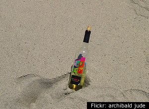
I'VE always said my wine consumption has been for medicinal purposes!!!!! HAHAHAHAHA!!!!!!

An article in the Journal of Agricultural and Food Chemistry asserts that drinking wine may actually help prevent sunburns. According to the study, the flavonoids present in grapes can stop the chemical reaction that causes cells to die, which is what causes skin damage. The study was conducted in vitro in a laboratory by the University of Barcelona and the Spanish National Research Council.
Grapes, therefore, can help protect from sunburn and even skin cancer, says the director of the research project. Cabernet Sauvignon skin cream, anyone?
Note: This study doesn't change the fact that drinking wine can make your face red, or that if you drink wine in the sun you might fall asleep, and thus get sunburned anyway.
An article in the Journal of Agricultural and Food Chemistry asserts that drinking wine may actually help prevent sunburns. According to the study, the flavonoids present in grapes can stop the chemical reaction that causes cells to die, which is what causes skin damage. The study was conducted in vitro in a laboratory by the University of Barcelona and the Spanish National Research Council.
Grapes, therefore, can help protect from sunburn and even skin cancer, says the director of the research project. Cabernet Sauvignon skin cream, anyone?
Note: This study doesn't change the fact that drinking wine can make your face red, or that if you drink wine in the sun you might fall asleep, and thus get sunburned anyway.
01 January 2011
Which Kind of Booze Is Best for the Planet? from MOTHER JONES NOV/DEZ 2010
FROM Mother Jones.......

An inconvenient vermouth: When it comes to global warming, why beer beats tequila, whiskey tops rum, and savvy New Yorkers buy French wine.
Murder in Detroit, overworked immigration judges, bruisers-for-hire on Indian reservations: If you've been reading Mother Jones lately, you're probably ready for a stiff drink. Not so fast! In terms of greenhouse-gas emissions, US booze manufacturers release the annual equivalent of 1.9 million households. How's that for a buzzkill? The good news is that you have choices. Here are a few tips for drowning your sorrows sustainably.
WINE: Fruity bouquet? Tastes like pencil shavings? Environmentally speaking, none of that matters: According to a 2007 study (PDF) commissioned by the American Association of Wine Economists, the majority of wine's carbon footprint comes from shipping. You can minimize your wine miles by using the handy map below. In short, New Yorkers should buy French, while Iowans are better off drinking California wines. If you're concerned about water use, go for bubbly wines made with early-harvested grapes. TRY: French Rabbit wines. They come in recyclable Tetra Paks, which reduce packaging weight by 90 percent over bottles. For reasonably priced organic wines, try Frey Vineyards—if the map allows.

BEER: In 2008, New Belgium Brewing Company commissioned an environmental analysis (PDF) of its Fat Tire Amber Ale and found that refrigeration accounted for almost one-third of its overall greenhouse-gas emissions. Glass production was second, contributing 22 percent. Though aluminum production is an environmental disaster, cans beat bottles handily on the carbon front: Pablo Päster, a blogger and sustainability consultant, calculates that shipping cans rather than bottles results in 30 percent fewer emissions. And cans are recycled at significantly higher rates. Good news for your inner frat boy: Kegs are the most efficient vessels of all. TRY: New Belgium. The Colorado-based company brews in superefficient kettles and is entirely powered by renewables.
DISTILLED SPIRITS: As we learned in college, liquor is quicker than wine or beer. But producing it uses more energy, ounce for ounce, and nearly all the water that goes into the still emerges as waste. Here's how selected spirits stack up.
Whiskey: Single malt Scotch is made from only one grain source, while most American whiskeys are made from mixtures of rye, corn, wheat, or barley. So which are greener? Most single malts are produced by boutique outfits using old-fashioned energy-hogging pot stills, as opposed to the more efficient column-style stills employed by major distillers. And while American bourbons are aged in virgin-oak barrels that are used only once, most of those barrels end up being reused by other liquor makers. TRY: Maker's Mark. The bourbon maker buys local grain and turns its waste into energy. Most of the company's land is a nature preserve.
Vodka and gin: Although some vodkas are still made from potatoes, most now come from a mix of grains. Ditto for gin. In terms of distillation, vodka requires more energy and water than most spirits. That's because it's distilled down to 95 percent ethanol—some ethanol plants even make vodka on the side—then diluted back to 40 percent. Gins are often made the same way. TRY: Square One vodka, which is organic and purchases one-quarter of its electricity from a local wind farm through renewable energy credits. TRU2 gin uses lightweight bottles and recyclable corks, and plants a tree for each bottle it sells.
Rum: The mojito enabler is made from molasses or cane juice, and its fibrous leftovers can throw off the microorganism balance in waterways. In 2001, the EPA sued Bacardi for illegally dumping 3,000 gallons of this goop into a river near its Puerto Rico plant. (Many major distillers now treat their water.) Sugarcane is also a notoriously destructive crop, producing massive amounts of wastewater and greenhouse gases. TRY: DonQ rum. The Puerto Rico-based distiller turns its waste into compost and irrigation water, and uses excess steam from its treatment plant to help power the still.
Tequila: Tequila's waste problem is as bad as rum's. For every liter of tequila, you get about 11 pounds of pulp and 10 liters of vinazas, or acidic waste—which ends up befouling soil and water in Mexico's Jalisco state, where most tequila comes from. Blue agave farmers, meanwhile, have used more and more pesticides since their crops were chewed up by insects during the 1990s. TRY: Casa Noble or 4 Copas, the first tequilas to be certified organic.
Got a burning eco-quandary? Submit it to econundrums@motherjones.com. Get all your green questions answered by visiting Econundrums on Facebook here.
WINE: Fruity bouquet? Tastes like pencil shavings? Environmentally speaking, none of that matters: According to a 2007 study (PDF) commissioned by the American Association of Wine Economists, the majority of wine's carbon footprint comes from shipping. You can minimize your wine miles by using the handy map below. In short, New Yorkers should buy French, while Iowans are better off drinking California wines. If you're concerned about water use, go for bubbly wines made with early-harvested grapes. TRY: French Rabbit wines. They come in recyclable Tetra Paks, which reduce packaging weight by 90 percent over bottles. For reasonably priced organic wines, try Frey Vineyards—if the map allows.
The Wine Line
If you live east of this line, European wines are better for your carbon footprint. Western oenophiles? Go green by buying Napa.
DISTILLED SPIRITS: As we learned in college, liquor is quicker than wine or beer. But producing it uses more energy, ounce for ounce, and nearly all the water that goes into the still emerges as waste. Here's how selected spirits stack up.
Whiskey: Single malt Scotch is made from only one grain source, while most American whiskeys are made from mixtures of rye, corn, wheat, or barley. So which are greener? Most single malts are produced by boutique outfits using old-fashioned energy-hogging pot stills, as opposed to the more efficient column-style stills employed by major distillers. And while American bourbons are aged in virgin-oak barrels that are used only once, most of those barrels end up being reused by other liquor makers. TRY: Maker's Mark. The bourbon maker buys local grain and turns its waste into energy. Most of the company's land is a nature preserve.
Vodka and gin: Although some vodkas are still made from potatoes, most now come from a mix of grains. Ditto for gin. In terms of distillation, vodka requires more energy and water than most spirits. That's because it's distilled down to 95 percent ethanol—some ethanol plants even make vodka on the side—then diluted back to 40 percent. Gins are often made the same way. TRY: Square One vodka, which is organic and purchases one-quarter of its electricity from a local wind farm through renewable energy credits. TRU2 gin uses lightweight bottles and recyclable corks, and plants a tree for each bottle it sells.
Rum: The mojito enabler is made from molasses or cane juice, and its fibrous leftovers can throw off the microorganism balance in waterways. In 2001, the EPA sued Bacardi for illegally dumping 3,000 gallons of this goop into a river near its Puerto Rico plant. (Many major distillers now treat their water.) Sugarcane is also a notoriously destructive crop, producing massive amounts of wastewater and greenhouse gases. TRY: DonQ rum. The Puerto Rico-based distiller turns its waste into compost and irrigation water, and uses excess steam from its treatment plant to help power the still.
Tequila: Tequila's waste problem is as bad as rum's. For every liter of tequila, you get about 11 pounds of pulp and 10 liters of vinazas, or acidic waste—which ends up befouling soil and water in Mexico's Jalisco state, where most tequila comes from. Blue agave farmers, meanwhile, have used more and more pesticides since their crops were chewed up by insects during the 1990s. TRY: Casa Noble or 4 Copas, the first tequilas to be certified organic.
Got a burning eco-quandary? Submit it to econundrums@motherjones.com. Get all your green questions answered by visiting Econundrums on Facebook here.
Subscribe to:
Posts (Atom)