BUCKNACKT'S SORDID TAWDRY BLOG
We should not be a journey to the grave with the intention of arriving safely in an attractive & well preserved body, but rather to skid in sideways, chocolate, bier or wein in hand, body thoroughly used up, totally worn out and screaming "WHOO-HOO, WHAT A RIDE!!!!!!"
NORTON META TAG
Showing posts with label extreme weather. Show all posts
Showing posts with label extreme weather. Show all posts
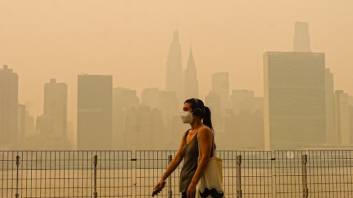
Brutal heat waves across the nation, epic wildfires in the heartland, submerged subways in New York–2026 is another banner year for climate extremes, so who’s to blame?
And more importantly, how do you prove it?
Researchers are chugging away on that problem even as the fossil fuel industry works to discredit “attribution science,” sowing disinformation about a discipline that aims to quantify how greenhouse gas emissions (and therefore major polluters) supercharge the adverse climate events we are experiencing ever more frequently.
“Bad weather is of course not new. So how do you show that emissions from company X cause injury Y from a hurricane or whatever?” attorney Michael Buschbacher, whose firm, Boyden Gray, sides with the fossil fuel industry in climate liability cases, asked during a Federalist Society panel last year.
How indeed.
This past week, I wrote about a new paper from Indiana University Earth systems scientist Christopher Callahan, whose promising statistical model measures the relationship between CO2 emissions and extreme weather. His approach could make it easier to hold industry accountable. “There is no level of emissions that does not contribute to changing climate impacts,” Callahan told me. “Every ton matters.”
The other climate scientists I spoke with agreed and praised the paper. Callahan’s work is “extremely valuable,” said Brown University climatologist Kim Cobb. “This would have been a pipe dream 10 years ago.”
Hopefully it won’t take another 10 to start making a difference in court.
For years, industry has argued you can’t prove which company caused which disaster. A new study says otherwise.
MOTHER JONES
SPONSORED CONTENT BY COLUMBIA RIVERKEEPER
New report on the most toxic place in America
Columbia Riverkeeper’s new report, “Hanford Nuclear Site Cleanup in the Age of Nuclear Uncertainty,” aims to help contextualize Hanford cleanup amidst an acceleration of federal deregulation around safety and oversight of nuclear energy, from lowering radiation standards to exempting advanced nuclear reactors from federal environmental review. Read it today!
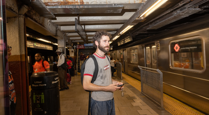
Jack Klein takes heat readings, bring fans to overheated passengers, and lugs big jugs of water with him.
THE GUARDIAN
HELP CLIMATE DESK THRIVE
A brighter future for journalism is possible—thanks to you.
Accurate news and information are essential for democracy. It’s the only way you can be sure that you’re getting the real story and hearing it from voices on the ground. At Mother Jones, we promise to keep pursuing the truth for you.
As an independent, nonprofit newsroom, we can do that work thanks to our readers. We’re not funded by billionaires or corporations but by the people who read and listen to our print, radio, and web investigations. People like you. Make a brighter future possible.
THOUGH America is headed for a government shutdown due to the irresponsible budget demands of the fascist heritage foundation's project 2025 on the NOT MY pres drumpf / trump, NOT MY vp vance, their cabinet and the almost total submission to them of the gop / greed over people-republican party it is still important that WE THE PEOPLE make our needs and expectations known by e mailing our elected officials. Please participate in this campaign for full funding for NOAA and FEMA from the Union of Concerned Scientist and be sure to personalize your letter if you can ( I did ). Before sending my letter through the link provided I copied and pasted it to e mails from me to my representative and senators ( see at the end of this post ). By the by, want to have more impact? Make your letter personal. More than 50 percent of Congress members report that form emails into their offices have some or a lot of influence over their position on an issue. But 92 percent report that individualized email letters have some or a lot of influence! Take action before disaster strikes, then it is too late.....
Climate change is fueling more frequent and destructive weather disasters, from hurricanes and wildfires to floods and droughts. At the same time, critical federal agencies such as the National Oceanic and Atmospheric Administration (NOAA) and the Federal Emergency Management Agency (FEMA)—responsible for weather forecasting, emergency preparedness, and disaster response—are facing dangerous budget cuts from the Trump administration.
The recent unimaginably terrible flash flood in Texas, with so many lives lost, is absolutely heartbreaking. Rescue and recovery efforts are still underway. We know that climate change is making these kinds of disasters more likely, underscoring the critical importance of NOAA and FEMA's life-saving work to protect communities across the nation.
NOAA is the nation's premier agency for science-based weather forecasting and climate science research and FEMA is the nation's leading federal coordinating body for disaster response and recovery. Yet right now, NOAA faces annihilating budget cuts and FEMA's resilience, mitigation, and community development grants are being reduced or completely eliminated in the upcoming federal appropriations process—just as the risks from climate change and extreme weather are growing more severe.
MY E MAIL TO REP SUBRAMANYAM D-VA 10TH DISTRICT, SEN WARNER D-VA AND SEN KAINE D-VA
As your constituent, I urge you to oppose any budget proposal that cuts funding to the National Oceanic and Atmospheric Administration (NOAA) or the Federal Emergency Management Agency (FEMA) or tries to dismantle or hinder the work of these agencies.
NOAA provides essential weather and climate data, supports coastal communities, and helps our country prepare for extreme weather and long-term climate risks. FEMA ensures that our communities are equipped to respond to and recover from disasters. These agencies are vital for public safety, infrastructure resilience, and science-based decision making.
Cutting their funding would be shortsighted and dangerous—putting more communities in harm’s way and undermining the science that guides life-saving policies. We are now in our 9th month of harmful, regressive and destructive policies and actions of the drumpf / trump-vance administration and the heritage foundation's project 2025. It is time to stand up to them and deny their plans for the degradation and destruction of our democratic Republic. I expect you to find the moral courage to make it so.
DROUGHT in the U.S. is not just a Western U.S. phenomenon and along with drought comes the increased risk of wild fires. Water is life and we have to stop acting like we are entitled to waste it. So at home if the water in your toilet is yellow it is mellow, if it is brown flush it down. Stop wasting water by rinsing dishes before loading in the dishwasher. Use the auto-fill setting on your washer to avoid over filling with water. Take quicker showers, and unless your hair gets really dirty because of your job or activities cut back to washing your hair once a week. At restaurants don't ask for water or tell your server you don't want any water if you are not going to drink it. Water your garden at dusk to give plants time to absorb water before it evaporates, limit watering your lawn to once a week (STOP mowing you lawn until the drought is over). From the Washington Post.....
Ian Livingston is a forecaster/photographer and information lead for the Capital Weather Gang. By day, Ian is a defense and national security researcher at a D.C. think tank.Twitter
The drought has come on quickly, meeting criteria for a “flash drought” because of its rapid onset. It began in June and has shown little sign of abating. It was the driest June on record in Virginia and also abnormally dry in neighboring states.
July has picked up where June left off. Thundershowers that swept through the region Wednesday night produced minimal rainfall, and most of the area has 3 to 4 inches less precipitation than normal so far this summer.
Percent of normal precipitation. (Ian Livingston)
The drought has worsened because of a vicious feedback cycle in which hot sunshine dries out the ground and causes temperatures to rise. The rising temperatures then speed up evaporation, which dries out the ground even more.
Drought change over the past month. (Ian Livingston)
The District is enduring its second-hottest summer on record so far, and Wednesday was the sixth consecutive day to reach at least 97 degrees, the second longest such streak on record.
Here’s how bad the drought is
A group of roofers take a lunch break after battling 95-degree temperatures Wednesday. (Ricky Carioti/The Washington Post)
The progression of the federal government’s drought monitor in recent weeks shows how drought has quickly expanded and intensified across the region.
Much of the area is now in moderate to severe drought, the second and third levels on a 1-to-5 scale.
While the intense heat has made the drought worse, its primary cause is the lack of rain. June and July are the region’s wettest months, but sunny skies have dominated.
The District has a rainfall deficit of 4.5 inches since June 1. Only 1.54 inches have fallen since then, third least on record. Baltimore and Dulles have received only 1.6 inches (eighth driest on record) and 1.75 inches (second driest on record), respectively, over the same period.
Precipitation during the past 30 days. (Ian Livingston)
The lack of rainfall has coincided with the summer solstice period when the sun is most intense. As a result, vegetation is suffering, with lawns turning brown and trees and other vegetation lacking water.
An improved outlook for rain
Some good news: Substantial rain could fall Friday, especially along and east of Interstate 95, where an inch or more could fall. Amounts will decrease to the west.
Predicted rainfall through Saturday morning from the National Weather Service. (WeatherBell)
Unfortunately, another round of excessively hot weather is predicted between Sunday and the middle of next week. Highs well into the 90s or even around 100 will quickly dry out the land surface again.
But after next week’s heat wave, a more promising weather pattern for rain could develop. The area is expected to sit between heat domes in the Southwest United States and western Atlantic Ocean, which will result in a southerly air flow.
While that will elevate humidity, it should also increase the potential for showers and thunderstorms.
The weather pattern forecast in 10 days from the European ensemble model shows an opening for more rain as the region sits near a dip in the jet stream between dominant heat domes. (WeatherBell)
If the remnants of a tropical storm or hurricane passed over the area, that would be the easiest way to dig out of the rainfall deficit. An active hurricane season is predicted, but there are no imminent signs of any storm that would turn into a big rainmaker for us.