
The languages of the U.S. — in one map
The Fix is (mildly) obsessed with maps — always have been — particularly ones that tell us something interesting about the country and its politics.
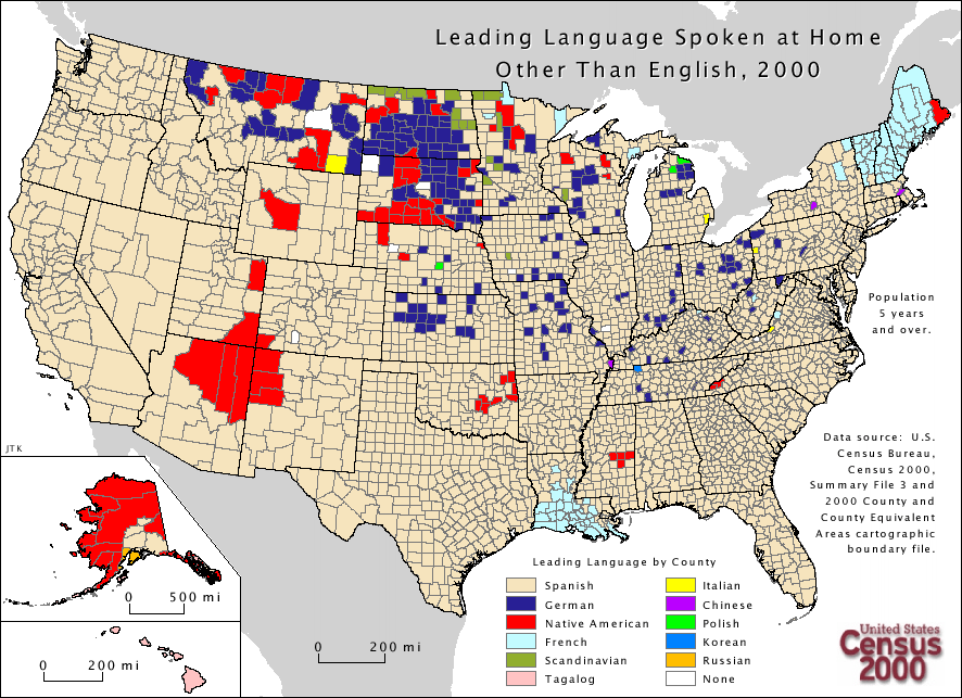
That’s why the map below, which details the leading languages, other than English, spoken in the home in each county across the country, is so fascinating. Who knew that Italian was so popular in a county in southeastern Montana? Or that French was so prevalent in all of Maine? Or that Scandanavian (Norwegian, Swedish etc.) was the prevalent second language in the northernmost points of North Dakota and Minnesota? The map serves as (yet another) reminder that most of all politics is (still) local.
The map comes courtesy of our friends at the Sunlight Foundation. (Click the map to see a bigger image on their site.)
http://arcgis.mla.org/mla/default.aspx
http://www.washingtonpost.com/blogs/the-fix/wp/2013/03/07/the-languages-of-the-u-s-in-one-map/
http://landofmaps.com/
No comments:
Post a Comment